
East Pennsboro Postal Delivery Labels
Two postal labels are verified in public sources tied to East Pennsboro Township. They are address examples and local context, not a claim that every township delivery point falls within either code. The Township office uses Enola 17025. County election and parks material also show Camp Hill 17011 addresses in East Pennsboro context. No authoritative reviewed source documented an additional township delivery ZIP, a PO-box-only ZIP, or a unique institutional ZIP. Check an individual address before adding another code to a research record.
| Postal delivery code | Verified township evidence | Postal label shown | Research caution |
|---|---|---|---|
| 17025 | Township office, Enola Fire Company, elementary and several eastern or northern polling locations | Enola | Dominant official-address label, not a municipal boundary |
| 17011 | West Creek Hills Elementary polling place and county park material | Camp Hill | Cross-boundary postal label, not proof of Camp Hill Borough jurisdiction |
This East Pennsboro postal reference organizes delivery labels, not parcel jurisdiction. The township, parcel, and legal description come from different systems. Treat each as its own field when saving an East Pennsboro Township source citation.
East Pennsboro Postal Boundary Quirk
The County's East Pennsboro polling-place listing makes the local overlap visible. It lists ten East Pennsboro districts, with Districts 1 and 3 meeting at West Creek Hills Elementary, 400 Erford Road, Camp Hill 17011. Other district locations use Enola 17025. A polling site is evidence of township precinct geography and postal addressing, not evidence that a person at a nearby address is registered there.
This distinction avoids a common records mistake. A Camp Hill ZIP code label can appear in Township material without moving the parcel into Camp Hill Borough. Likewise, an Enola label does not replace the municipal field in the County's assessment and GIS systems. Confirm delivery spelling through USPS, then use the parcel tools to check the relevant municipal and property context.
Postal label versus jurisdiction. A mailing city helps delivery, while a parcel record and legal description establish the geographic record trail.
Verify an East Pennsboro Delivery Address
The USPS address lookup is the documented tool for one delivery address. It is not an East Pennsboro Township property or people filter. Enter the street number and street name as completely as possible, then keep the returned postal form with the source date. For historical research, preserve the original wording alongside the standardized result. A directional prefix, unit, village label, or spelling difference can be essential when the next system cannot find an address.
- Enter the exact delivery address in the USPS lookup and save its displayed postal form and the lookup date.
- Enter the street number and street name in County Property Mapper, leaving off nonessential postal text if its first search does not resolve.
- Use the County result's PIN, if available, to open the same parcel in Property Mapper or DataScout.
- Save the situs address, municipality, PIN or UPI, and legal-description wording separately from the postal label.
- For an older address, retain every printed variant and ask the Township or County office about a specific documented mismatch.
This is an exact-address workflow. The research found no verified ZIP-wide method in the local property tools, so a ZIP alone should not be used as a shortcut to a complete address list.
East Pennsboro Postal Label to Parcel
The County web-mapping page identifies the address route to Property Mapper. The capture below is the successful ZIP-context mapping source from the project manifest. It points to county mapping, not to a ZIP-filtered roster.
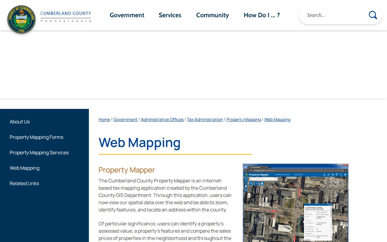
Property Mapper accepts a street number and street name or a PIN, and the selected parcel can be clicked for county-described assessment context. Cumberland County DataScout documents parcel-number and address as its basic routes. Both tools begin with a defined property. Neither reviewed description documents a ZIP-wide people or parcel filter.
Note: Keep the postal city and ZIP with the original address record, but use the PIN or legal description when comparing official county sources.
Enola Postal Labels in East Pennsboro
Enola is both a postal label and a historical place name. The Historical Society of East Pennsboro describes its rail-yard and railroad-community development. That history makes Enola useful for East Pennsboro Township catalog, photograph, newspaper, map, and directory queries, especially when an older source never uses the full township name. It does not convert every Enola-labeled address into a separate municipality or identify a current household.
Summerdale and West Fairview require the same care. Summerdale is tied to 1909-era growth in the local history, while West Fairview is the riverside village represented by the 1910 Sanborn map. The three East Pennsboro Township terms can be saved as historical search variants next to, not in place of, the delivery address. East Pennsboro Township is the jurisdictional term used for the county parcel and election context.
County geographic material supplies a useful check without creating a people record. The 2024 Conodoguinet Creek Water Trail guide identifies Adams-Ricci Community Park at 100 East Penn Drive in Enola, while County parks material uses both Enola 17025 and Camp Hill 17011 labels for East Pennsboro Township locations. These public facilities illustrate postal overlap and map vocabulary. They do not establish who lives near a park, which postal label belongs to a surrounding parcel, or a complete delivery-area boundary.
East Pennsboro Address Number Variants
A 2015 East Pennsboro readdressing project affected 20 addresses after two locations were identified as “600 South Enola Road.” This documented problem is why a delivery ZIP and a street number cannot be treated as permanent identity keys. The research did not provide a universal old-to-new address crosswalk or identify each changed property. A source from before the change needs its own date and its original address text.
When an old number fails in USPS or Property Mapper, first remove nonessential city or postal text and retry the street number and name. Next compare a deed, assessment document, or existing parcel record for the PIN or UPI. The county required tax parcel numbers on specified real-estate documents beginning October 1, 2008, making that identifier a useful bridge across street-formatting differences. It still does not prove that two similar descriptions are the same parcel.
East Pennsboro Township history gives this check a clear local purpose. Enola developed with the rail yard, Summerdale was laid out in 1909, and West Fairview has a riverside 1910 map record. Interstate 81 relocation affected local geography in 1972. A historic document can therefore carry a village term, road description, or address presentation that differs from a current East Pennsboro Township postal result. Preserve the printed source date, place term, complete number, and parcel key. Do not overwrite an earlier form merely because a modern delivery lookup uses different wording.
East Pennsboro Postal Fields to Save
Separate fields make later checks much clearer. A mailing address may be a destination for notices, while the situs address identifies where a parcel lies. A legal description and PIN or UPI are the county and Recorder anchors. The County's online-property guidance cautions that some information, including owner mailing addresses, may not appear online. Do not fill a missing field with an assumption drawn from the postal city.
- Postal delivery code
- A delivery code can cross municipal lines and should be verified for the individual address.
- ZIP+4
- An added delivery-segment code. The reviewed research did not identify it as a township boundary or parcel key.
- Situs address
- The physical location of the parcel in county property records.
- Mailing address
- The address used for notices when available under law. It is not automatically the parcel location.
- PIN or UPI
- The county parcel identifier used to connect mapping, assessment, and many recorded-property documents.
East Pennsboro Postal Search Limits
The East Pennsboro postal reference has a narrow task: verify a delivery label and help prepare a precise address search. It cannot establish a ZIP-wide list of people, properties, or voters. East Pennsboro Township Property Mapper and DataScout document address or parcel-number routes, not a ZIP filter. Pennsylvania's individual voter-status service is for the voter, and the controlled voter-file request process has statutory restrictions and a prohibition on internet publication of the listed files.
For a defined East Pennsboro Township parcel, the next source is the County assessment or GIS record. For an East Pennsboro historic question, use the place terms and dated collections at CCHS or the branch library. For a delivery question, return to USPS. That division of work avoids treating East Pennsboro postal geography as a substitute for a public-records custodian.
Privacy boundary. A postal label or parcel result is not permission to compile personal information, pursue a person, or defeat a protected address.
East Pennsboro Postal Names Over Time
Postal words, village names, and municipal records may all describe the same area differently. The Township dates to 1745, Cumberland County to 1750, and later boundary changes affect how early sources are titled. Enola, Summerdale, West Fairview, and East Pennsborough are useful historical queries, but every result needs the source's own date and geographic scope. A street number in a directory, a ZIP on an envelope, and a deed description should remain distinct pieces of evidence.
For a fuller East Pennsboro Township address-by-address record trail, the East Pennsboro street directory follows the County address and parcel route. The postal reference ends once the delivery label has been verified and the exact address is ready for that handoff.